This past Sunday found me finding and photographing a number of cemeteries. My friend Bob and I found and were able to photograph three family cemeteries, know where another one is and had a problem finding one due to all the over growth. I also photographed three other larger cemeteries on my own.
I was hoping to sleep in on Sunday morning, but my body decided that waking up at a normal time of 6am was perfectly fine. Since I knew I wasn't going back to sleep I decided to use the morning light to get some photos in.
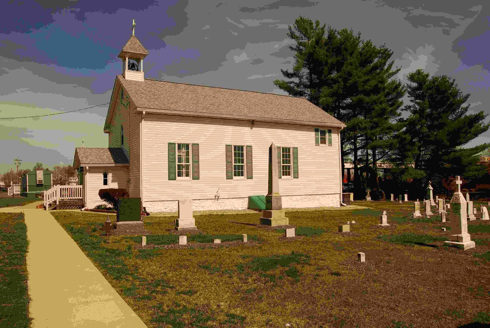
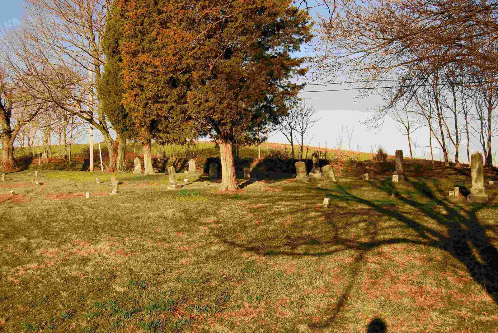 |
| Mount Pleasant Cemetery |
My first stop was
Mount Pleasant Methodist Church Cemetery, which is actually in Montgomery county, but was cataloged by Holdcraft in
More Names in Stone (MNIS). Find a Grave seems to have most, if not all, of the stones photographed, but since it was in MNIS I decided to go ahead and take photos as well.
After I stopped by the Waffle House in Urbana, I then went to
Zion Church Cemetery. I was able to take photos of most of the cemetery, but I needed to leave before I finished to pick up Bob.
Our first stop was to the
Simpson Family Cemetery 2 off of Fountain School Road. I knew where this one was because of a comment one of my other posts. When we pulled in to the driveway though the families that live there were planning an Easter Egg hunt, even though it was a week past Easter, for the kids and we didn't get a chance to stop and see the cemetery. Even though we couldn't get to it, I now know where it is.
 |
| Simpson Family Cemetery 1 |
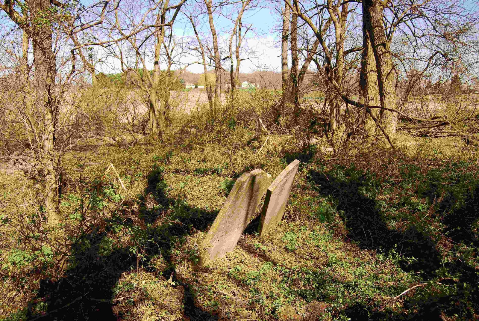
Our second stop was
Simpson Family Cemetery 1, which is in the middle of a field on Fountain School and Coppermine Roads. As Bob and I walked across the field we reminded each other that of course we're related to the family buried there, and isn't Homer, Bart, Marge, Lisa and Maggie a great family?
The cemetery itself is not in the best condition, only a few of the stones were standing, and a few were partly or almost totally buried. Most of the stones were readable, though a couple were getting to the point of being worn totally down. We were able to find all but a couple of stones that Holdcraft had listed, though with looking I'm sue they are in the brush somewhere.
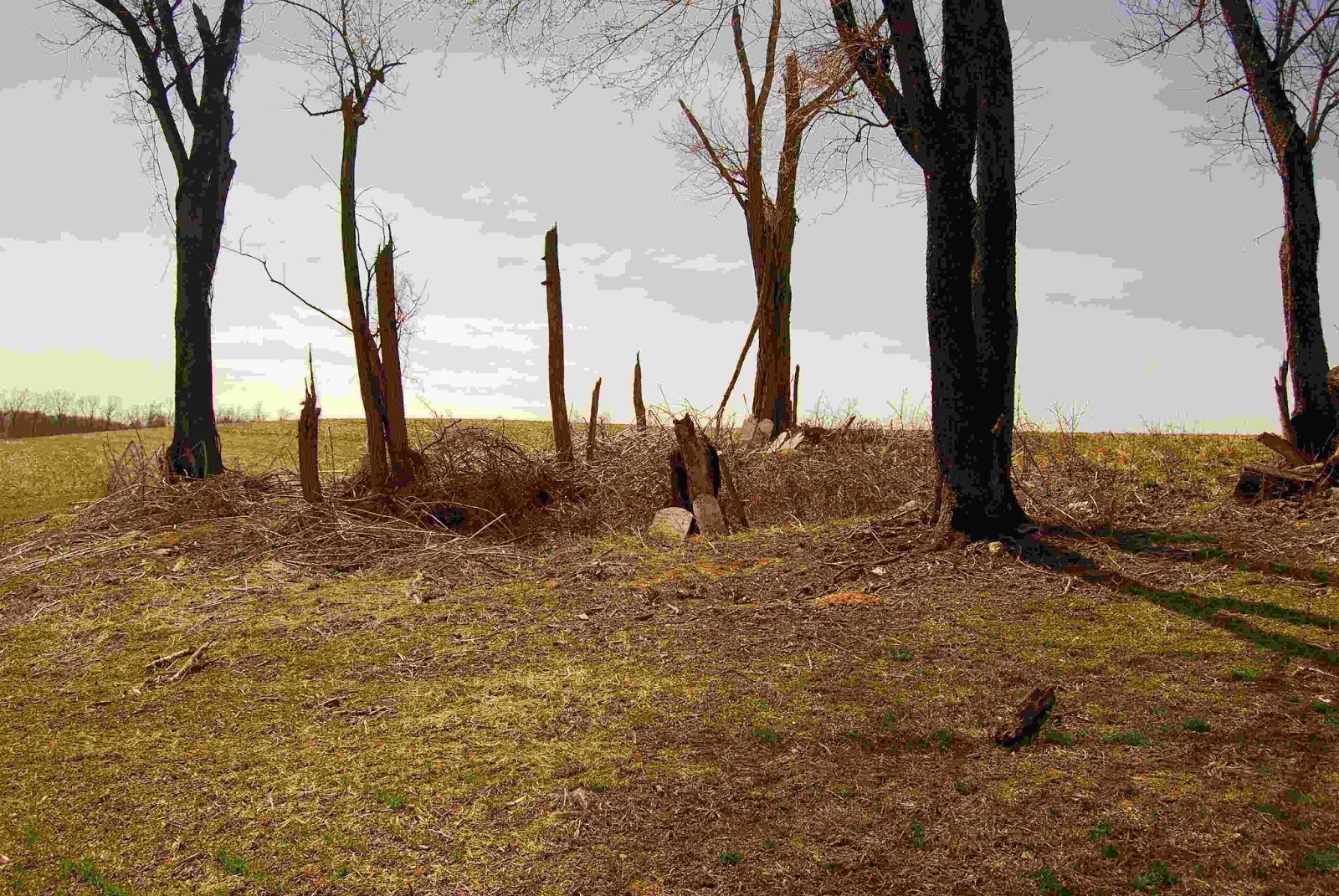
Our next stop was the
Norris Family Cemetery. It was obvious that this cemetery had been moved as the stones were pretty much just stacked in one area, this did make it easy to photograph though. There is one stone that
MNIS listed that was not there, however, we saw what looked to be a stone inside of an electric fence that was mostly buried. MNIS also lists seven names and I have only been able to locate in the book, I also have a photo of a stone that doesn't seem to be listed and might have been missed by Holdcraft.
 |
| Grabill Family Cemetery 1 |
Next on the list was the Grabill Family Cemetery 1, not listed on Find a Grave. For this one I had a general idea of where it was and we stopped at the farm that I thought it was on. The man who answered the door knew right where it was at. Again, this cemetery was badly overgrown with weeds and thorns. We found a number of stones, a few of which were buried. Right now I haven't been able to cross reference NIS with what I've found to see if there are any missing stones or not. I wouldn't be surprised if there were a couple missing.
After finding three and a half cemeteries we made our way across the county to Burkittsville to the
Slifer Family Cemetery. We found the correct farm that the cemetery was located on/next too, but we were unable to find the actual cemetery. This is a bit strange as it's large, 20 or so stones, and is listed in the Titus Atlas.
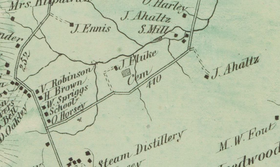 |
| Petersburg district from Titus Atlas, the road to the south of the cemetery is no longer there. |
 |
| Saint Ignatius |
After dropping off Bob I still had daylight left so I decided to finish taking photos of Zion Church and since I was there Saint Ignatius Catholic Cemetery as well. All in all a very good Sunday for taking photos and finding old family cemeteries.